Click to view our Accessibility Statement or contact us with accessibility-related questions


Mission - Lost Creek Wilderness

search
close
Sort by: Newest
keyboard_arrow_downCaptainQuinoa
46
May 27, 2017
I've done many trips into Lost Creek. Nice review. If you go at the right time of year there are many berries to forage after just leave some for the bears.

SawatchFactory
300
May 27, 2017
CaptainQuinoaI forgot about those until you mentioned it. Wild raspberries on the way down Rolling Creek.
Related Posts

gnarledcoulee
Canoe-camping on a remote lake island in northern Nova Scotia.
May 25th, 2019 Took a last minute solo canoe-camping trip yesterday down Masons River into Belfry Lake in eastern Cape Breton, Nova Scotia, Canada. After concocting a system involving several fleece blankets, I managed to unload my new 80lb beast of a canoe off the top of my car on my own. Pushing off at about 1pm, I paddled down Masons River from Gabarus Lake South. Battled a 40km/hr head wind coming off the nearby ocean once hitting the open lake. After a 2km paddle down Masons River into Belfry Lake, I paddled two more kms, making my way to the northern edge of the lake and on to the last of three large islands in the lake named Rams Head Island. While I was launching my canoe, a man told me one of the three islands has a Scottish pioneers cemetery located on it. abandoned home along Masons River paddling across Belfry Lake towards Rams Head MacLeods Island, MacIsaacs Island and Rams Head Island in Belfry...
May 27, 2019

backpackerPT
A Journey to Ultralight
The pack was blue. Bright blue, with a shiny aluminum metal frame. I walked all over the house with it, stuffed with my dolls and animals and my plastic bow and arrow and at times, the cat. I couldn’t wait to join my dad in the Boundary Waters of northern Minnesota, canoeing and hiking and fishing for 2 weeks. I was 5. The rule then, in 1975, was that if I wanted it on the trip I had to carry it. Dad wasn’t going to carry it, Mom wasn’t going to carry it, my 2-year-old brother certainly wouldn’t carry it. If I wanted to bring it, it had to go in my pack and I had to schlep it. If we were in the middle of the wilderness and I didn’t want to carry my prized stuffed dog named Emmitt anymore, well then that matted bit of fur was going to be left in the middle of the wilderness, all alone. That was enough to scare me to leaving the dog at home, as well as the plastic standing robot that actually shot darts with suction cups, the bow and arrow set, and my indian...
Mar 13, 2017

Fanaticmind17
Biaggi Hangaroo Duffel Bag
Description Traveling with a suit, a dress, or anything that needs to be hung can be a hassle but the Biaggi Hangeroo Garment Satchel will make your business trips and weekends away a whole lot easier. This ingenious garment bag doubles as a spacious carry-on satchel, so your days of lugging around a garment bag and a carry on are behind you! Once you pack your hanging dress clothes, simply zip the wide side panels up, and you're left with an interior main compartment roomy enough to pack all of your carry on belongings. The satchel’s rounded edges keep your clothes fresh and wrinkle free, and zippered pockets and a cushioned shoulder strap, provide practical functionality. Once home or unpacked in your hotel, the Garment Satchel folds completely flat and can be stowed away until your next getaway Features Two bags in one! Garment bag transforms into a carry on duffel, large enough to pack for a long weekend or to use as your carry on for a...
Apr 14, 2018
Oro-Lee
Backpacking quilts
Just discovered these things. I think they would work pretty well in a hammock, not so sure about sleeping on the ground. What do y'all think? Drop-worthy?
Jun 23, 2017

SawatchFactory
Mission - Lost Creek Wilderness
This is a story of choices. Some were good, some potentially deadly. Necessity and Planning After the first twelve months of fatherhood, I needed to pop the release valve. My wife had been able to get away for a long weekend in California for a bachelorette party. I hadn’t had an opportunity to get away for more than a half day for a ski tour. And, while I was exceptionally grateful both for the new addition to our lives and those few hours of touring, it wasn’t enough. I began planning. I knew that I wanted to take a solo trip. I also knew that I wanted to test myself. At first, I wasn’t sure how that test would work. I’d probably figure it out later. Let’s begin with a location. Colorado is home to vast swaths of wilderness. I wanted to be in one of them. I was also working with a limited timeframe, which knocked out some wilderness areas that are on my bucket list. Weminuche wasn’t going to happen. Really, the shorter the drive the better. It meant more...
May 25, 2017
Trending Posts in More Community Picks

Graham88
Completely surprised by the lack of blade diversity here on Drop...
I’ve been a collector of Blades since before my teens, and a retailer coming up on 15… or maybe 20 years. Drop has really been kind of an interesting experience for me, because I do occasionally get to see some unusual tech and sometimes EDC items that otherwise I might not have been aware of. And maybe it’s because I have a deep love of cutlery and bladed weapons, but I find myself trolling through the site looking at it what’s available; and it’s just it’s pretty much the same. And the bladed community here is just always confused me.. every single knife is about the same, they’re almost all drop points and although the handle materials change and brands change.. it’s really just the same knife over and over and over again... occasionally you’ll see a tanto or a slight variant; but rarely… and almost never a serrated blade. And I’m just deeply amazed at this diversion of serrated blades. And I’m just surprised there isn’t more of a request for diversity here.... and I...
Mar 12, 2020
JellyDPhoto
Can we get Sony E-Mount or other mirrorless camera options please..
Would be nice to see some Sony E mount full frame cameras on here. I currently shoot with a A99 and they killed the lense path for better or more option lenses and now is all E-Mount. 🤔
Jan 13, 2020
RayF
There Are Pandas, and Then There Are Pandas.
And this isn't either of them! The Pandas we're talking about here, are watches, not bears. And what got me thinking about them (again) was a link posted this morning by @cm.rook who pointed a few of us to the very attractive (and not terribly priced) Yema "Rallygraph" Panda which, in it's most traditional arrangement, looks like the one on the left, but can also be had in the version on the right: The model on the left is a true Panda, while the model on the right is called a reverse Panda. The reason for that distinction is clear--Panda bears, only come in the first arrangement. Now at this point, everyone should be thinking about the most well-know Panda, The Rolex Panda, which is actually a Daytona, and among Rolex Daytonas, the most famous of which is the Paul Newman Daytona, which was famous first, because it was Paul's, and second because it sold at auction for $17.8 million (US Dollars). The story of that auction is well-known so I'll only...
Nov 8, 2019
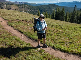
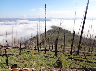
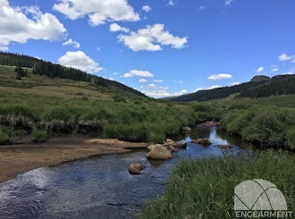


Necessity and Planning After the first twelve months of fatherhood, I needed to pop the release valve. My wife had been able to get away for a long weekend in California for a bachelorette party. I hadn’t had an opportunity to get away for more than a half day for a ski tour. And, while I was exceptionally grateful both for the new addition to our lives and those few hours of touring, it wasn’t enough. I began planning.
I knew that I wanted to take a solo trip. I also knew that I wanted to test myself. At first, I wasn’t sure how that test would work. I’d probably figure it out later. Let’s begin with a location.
Lost Creek’s namesake is a small flow that dips into rockfalls and disappears underground as it meanders across the landscape. The area was, at one time, home to a misguided attempt to dam the creek for water storage. Remnants of that attempt – a pair of bunkhouses and some large machinery – rest in the wilderness, slowly deteriorating.
I began downloading USGS quads. I love USGS quads. I love that the government keeps every map the USGS has ever generated. I love perusing the same map drawn three times over the course of fifty years and seeing marked trails shift and disappear and reappear across the decades.
The route began to take shape and it was ambitious – a test of my ability to cover distance. It covered more than 50 miles from the Brookside/Payne Creek trailhead, touching almost every corner of the wilderness area. I spread the quads out on the conference table at the office. Lost Creek covers six quads north to south and four east to west. Then I stacked the older maps under the newer ones. I numbered each quad and drew a diagram on each page noting the order so I could reassemble them easily if needed. I traced the route with a highlighter.
Once I get into the woods, I rely primarily on Nat Geo Trails Illustrated maps. I picked one up at REI and traced the route a second time, this time in Sharpie. I tucked the Trails Illustrated map into an OpSack along with the USGS quads
It’s important that people know where you are in the wilderness, especially if you’re going solo. So, I headed over to mapmyhike.com and traced the route a third time, electronically. This I shared with my wife and a few friends, just in case.All this logistical planning was complete a month before the trip. So far, mostly good choices.
Packing and Adding a Challenge With a week until go-time, I started organizing my gear. My pack is an REI Flash 45. It’s light, but not ultralight, and has a frame strong enough to provide some support. For shelter, I packed the Big Agnes Krumholtz we had in for testing, along with the entirety of its Goal Zero MTNGlo system. The Krumholtz alone is only one or two pounds heavier than my usual shelter selections, but adding the entire MTNGlo kit put another 2 pounds in my pack.
Sleeping duties were borne by my 15° Montbell UL Super Spiral down bag and Exped Synmat UL 7. Trail clothing consisted of a pair of Patagonia Strider Pro shorts (I’m in the old version) with Polygiene in the liner (fucking crucial!) and a Mountain Khakis Trail Creek shirt. I had a Patagonia Duckbill Trucker on my head and their Sun Mask around my neck – without a doubt, my favorite gaiter because, as far as I know, they’re the only ones that extend and widen the bottom so it actually covers the back of your neck without leaving a gap. I packed my GoLite Bitterroot down puffy and something – I forget what – to keep my legs from freezing at night. Shoes were an older model of Altra’s Superior trail running shoes and socks were some thin merino items from Sock Guy. A bit heavier than usual, but not bad.
Left wrist sported the ever-present Suunto Ambit 3 Vertical while right wrist always rocks a RoadID with emergency contact info. They have to know where to send the body, right?
Somewhere along the line, I decided to add a bit of a challenge to the trip: complete the entire hike while eating as few calories as possible. Why? I can’t tell you. Really. I don’t know where the idea came from or why I thought it was good. I didn’t completely skip packing food. I brought two dinners and a few Kind bars. Nowhere near what my body would consume over 50 miles of trails, even if the route was entirely downhill, which it was not.
With a pair of full water bottles and Vapur’s microfilter strapped to my shoulder strap, I’m guessing I headed out from the trailhead with a 45-pound pack. Poor decisions put me about 20 pounds heavier than my usual load. I know the math doesn’t add up.
Day One – 14 Miles of Ow
The high point was nothing. The trail simply flattened out for a bit and then unceremoniously dropped steeply into a valley. Two downhill miles brought me to the Colorado Trail, Segment 4. It was now early afternoon and, for the first time, I started seeing people. Lots of people. And cows.
As I refilled my water bottles in the creek, I weighed my options. One the one hand, my plan had me putting another four miles in before the end of the day, sleeping somewhere on the Brookside-McCurdy trail near Bison Peak. On the other hand, I felt done.
Day Two – Bailing and Hitchhiking
The Wigwam trail slices Lost Creek Wilderness almost in half, cutting through the gorgeous Wigwam Creek valley. For the first time, I got to see the granite domes for which Lost Creek is famous. The trail was relatively smooth and flat, and I wound up hiking with a couple of guys who were setting a nice pace on their way to fishing and camping on one of the spur trails. Those miles went by quickly.
Sitting at the top of Rolling Creek trail wasn't going to help and downhill is easier than up. I could at least make it to the Rolling Creek trailhead. The north side of Rolling Creek trail actually runs along Rolling Creek and crosses some of its tributary springs and brooks. I stopped to refill water and take some pictures. Farther down the trail, I found wild raspberry bushes and picked them as I walked.
On the way down, I ran into a couple of hikers. They looked a bit out of place, wearing street clothes and gym shoes. We struck up a conversation. They were New Yorkers and Polish immigrants – him a cab driver, her a teacher in Brooklyn. They owned a small vacation home in Bailey and spent a month in Colorado every summer, exploring the mountains. They had driven in to the Rolling Creek trailhead and hiked up the trail a few miles to see what they could see. I wowed them with my Polish vocabulary, which consists of one word – cześć. This was my opportunity.
As we hiked, I asked if there was any way they could shuttle me back to my car. Sure. No problem. It’s on the way.
Oh. Yes. Thank you.
We chatted a bit more as we drove down some Forest Service roads toward civilization. COMBA, our local mountain bike association, was doing trail work on the very southwest corner of the Buffalo Creek Recreation Area and had signs posted along the road directing volunteers. They do good work.
We drove through Bailey and turned onto the same road where I’d started the day before. As we pulled into the parking lot, I sighed to myself. You’re stupid and you’re lucky, Dave. Let’s not do this again.
Live and Learn A planned 50 miles turned in about 31. Two nights turned into one. Was I ever in real danger? Who knows. It didn’t feel good and not in an “oh, this is uncomfortable” sort of way. I’ve felt discomfort before. I’ve walked most of the marathon segment of an Ironman because my feet were covered in blood blisters. That was uncomfortable. This was a body running on fumes, struggling to process enough reserve fuel to keep moving.
My gear selections were fine. It wasn’t that I chose the wrong pieces. The basic kit worked well – shorts were comfortable, shirt was light and provided adequate sun protection, shoes and socks kept my feet in good shape, tent kept me dry, and sleep system kept me warm and comfortable. Rather, I packed way too much. I’m always the one asking companions “do you really need that?” Funny how on a solo trip, I failed to ask myself the same question.
If there’s a lesson here, it’s certainly not to avoid challenges. But it may be to choose challenges where success is not the only option and where failure doesn’t come with such dire consequences. I’ll be packing fewer cameras and more food next time around.
This story originally appeared on Engearment.com